Follow us


Authentic hiking The Ruitor glacier
Duration:
5 days
Price from: 780€
Fitness:


Infobulle physique
Physical Level 1: For individuals who engage in occasional physical activity, positive elevation gain up to 250m or distance up to 5km.
Physical Level 2: For individuals who engage in regular physical activity, positive elevation gain up to 500m or distance up to 10km.
Physical Level 3: For individuals who engage in regular endurance activities, positive elevation gain up to 1000m or distance up to 20km or multi-day routes with carrying personal belongings for the day.
Physical Level 4: For individuals who engage in regular endurance activities, positive elevation gain up to 1400m or distance up to 25km or multi-day routes with carrying personal belongings for the duration of the trek.
Physical Level 5: For individuals who engage in intensive endurance activities, positive elevation gain exceeding 1400m or distance exceeding 25km.
Technique:
Infobulle technique
Technical Level 1: For walkers, capable of navigating wide mountain trails suitable for vehicles.
Technical Level 2: For occasional hikers, capable of navigating non-technical mountain trails.
Technical Level 3: For regular hikers, capable of navigating slightly uneven mountain trails with roots or rocks.
Technical Level 4: For experienced hikers, capable of navigating rugged mountain trails with boulders, large steps, or exposed sections.
Technical Level 5: For seasoned hikers, capable of navigating off-trail routes or mountain trails with equipped sections, such as cables or ladders.
Comfort :


Level 1. The comfort of your stay is minimalist. You sleep in a tent and carry your personal belongings throughout the stay.
Level 2. The comfort of your stay is limited. You mostly sleep in refuges or hostels, in dormitories, and carry your personal belongings throughout the stay.
Level 3. The comfort of your stay is intermediate. You mostly sleep in refuges, hostels, or hotels, in dormitories. Assistance is provided for the transport of your personal belongings, when possible.
Level 4. The comfort of your stay is high. You mostly sleep in hotels, in rooms. Assistance is provided for the transport of your personal belongings, when possible.
Level 5. The comfort of your stay is very high. You mostly sleep in 3- or 4-star hotels in rooms. Assistance is provided for the transport of your personal belongings, when possible.
General information
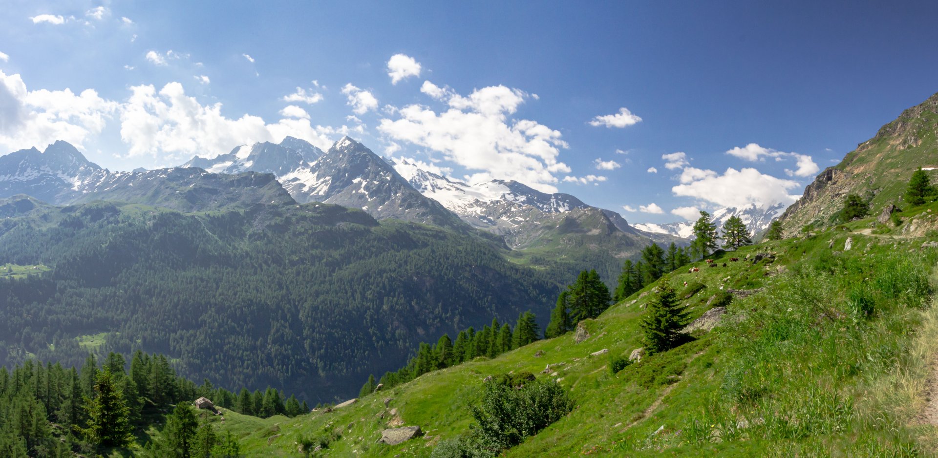
In the continuity of the Tour du Mont Blanc, this journey offers an exceptional opportunity to extend your exploration through the Italian Alps. Rising to 3,486 meters above sea level, Mont Ruitor proves to be one of the gems of Valle d’Aosta. Unexplored, it extends across Italy and France, bringing together wild valleys, high-altitude lakes, and remarkable viewpoints on the glaciers. The panoramas of the Mont Blanc, Grand Paradis, and Vanoise massifs are also numerous and breathtaking. The circuit unfolds in a preserved environment where flourishing biodiversity, alpine meadows, and crystalline rivers add a unique dimension to this trekking experience, inviting everyone to fully connect with the surrounding nature. This route provides a total immersion into a preserved alpine ecosystem.
This journey is also an opportunity to savor the exceptional hospitality and warm accommodations in traditional refuges. The inhabitants of Val d’Aosta perpetuate an incomparable culture, renowned for the warmth and kindness of its people, based on the idea that everyone is always welcome, and there is never a problem. Enjoy the expertise of a mountain guide without worrying about logistics. Simply carry your essentials in your backpack for a mountainous experience in complete fulfillment. Accommodation is in refuges with nights in dormitories, and supplies are ensured by the refuges.
This journey is part of a series of programs we have developed to extend the experience of the Tour du Mont Blanc. Our itinerary, connecting Chamonix to Zermatt, or our route straddling the Valais and Bernese Alps, will allow you to enjoy the picturesque ambiance of the Swiss Alps. Similarly, our route in the Grand Paradis National Park or around the Ruitor will let you savor a bit more of the Italian Dolce Vita in the heart of Val d'Aoste.
Group booking
The collective formula associates several people who do not necessarily know each other. It allows for a planned program to benefit from an attractive price on fixed dates. This formula is ideal for people looking for the friendliness of a group.
Dates : See below for the group booking module
Price 2026 : 780 € per person - based on a minimum of 6 participants
This price includes:
- the organization of the trip
- the supervision by a state qualified trekking guide
- half-board accommodation, including dinner, breakfast, and overnight stay, in a refuge (dormitory)
- picnic lunches
- transfers throughout the hike
This price does not include:
- Transportation to the starting point of the hike
- Accommodation before and after the hike
- Personal expenses: souvenirs, drinks, etc.
- Ski lifts or taxi transfers in case of personal inability to complete the planned stage
- Mandatory repatriation insurance. Cancellation insurance is strongly recommended. (Residents of the following countries—Andorra, Austria, Belgium, Denmark, Finland, France, Germany, Gibraltar, Greece, Ireland, Italy, Liechtenstein, Luxembourg, Monaco, Netherlands, Norway, Portugal, San Marino, Spain, Sweden, Switzerland, and the United Kingdom—can purchase repatriation and cancellation insurance at the same time as their trip registration. This insurance is non-refundable in case of cancellation.)
- Booking fees
- Anything not mentioned under "This price includes"
Private booking
Want to go hiking with family or friends? Want the freedom to choose your departure dates*, enjoy a tailor-made itinerary adapted to your desires, and benefit from guidance specifically suited to your level? Choose the private package!
This is the traditional relationship between a guide and their clients. It allows you to be alone or in a group with your guide, who will respond to your specific needs. The ideal package for realizing your plans, as it guarantees maximum comfort.
Discounted rates based on the number of participants.
*Subject to availability of accommodation.
Contact us for a quote.
Further information
In this section, find all the information about this activity. To prepare your trip effectively, refer to the guides’ tips. They share their expertise and recommendations, ensuring you have a great experience
Meeting Point : Departure at 8:00am at the Compagnie des Guides, 190 Place de l’Eglise, 74400 Chamonix Mont-Blanc.
Ability Level : 4/5 - The Tour du Ruitor is a strenuous hike. It involves a minimum of 3,280 feet of positive elevation gain and an average of 6 to 8 hours of walking per day. The hike covers varied mountain terrain, which may include technical difficulties (equipped and secured passages, short sections with ladders) or exposed sections. It may also involve off-trail hiking on challenging terrain like scree slopes. Good experience in multi-day mountain hiking is required. Participants should be physically fit and in excellent condition.
Itinerary: The guide may need to adjust the itinerary based on weather conditions and/or the physical and/or technical abilities of the group
Guiding policy : minimum 6 and maximum 12 people per guide. The Compagnie des Guides de Chamonix's guiding policy is one of the strictest in the mountain guiding business. It guarantees the most balanced groups as possible as well as high-quality personalised advice. Registration possible from 16 years of age. Registration is not permitted to anyone under the age of 18 without a legal guardian.
Accommodation :
- During the stay: 4 nights in refuge (in dormitories). You will carry your personal belongings in your backpack.
- Before & after the trip : benefit from preferential prices from our partner hotels in Chamonix.
Documentation :
- Participants must have sports insurance with repatriation cover. We strongly recommend that this also includes cancellation cover. You can take out insurance offering both of these types of cover when you sign up.
- Participants must also take valid ID with them.
Preparing for the trip : There is an information meeting with your mountain leader the day before departure at 6pm at the Compagnie des Guides Office.
Equipment
Weight is a hiker's adversary, so it is crucial to carefully select your equipment as it plays a key role in ensuring the success of your trip. The weight of your backpack, including all your belongings, should not exceed 9kg
Your gear
- A 40L backpack
- A pair of top quality hiking boots
- A pair of telescopic poles
- A hat or cap
- A warm hat
- Category 3 sunglasses
- Breathable long and short-sleeved T-shirts
- A polar fleece
- A warm down jacket
- A Gore-Tex waterproof jacket
- A rain poncho
- A hiking trouser
- A Gore-Tex waterproof trouser
- Shorts
- A pair of gloves
- Hiking-appropriate socks
- A minimum 2L water bottle
- A pocketknife and a spork
- A flashlight or headlamp
- Sunscreen and lip balm
- A sleeping bag liner
- Toiletry kit, towel, earplugs, and toilet paper
- Minimal personal pharmacy: blister pads like Compeed, medications for common ailments such as diarrhea, constipation, sore throat, headaches, pain, allergies
ID, money for personal expenses
- Flip flops for the hut
- Spare clothes as per your preference
Our Rental Partners : You can rent your equipment with our rental shops partners and benefit from special price Millet (excluding crampons, ice axes and helmet), Sanglard Sports, Ravanel & Co & Concept Pro Shop
Our Equipment Partners : Millet, Dynastar, Julbo, Grivel & Monnet
Itinerary
Day 1
Colle San Carlo (La Thuile) - Refuge Deffeyes
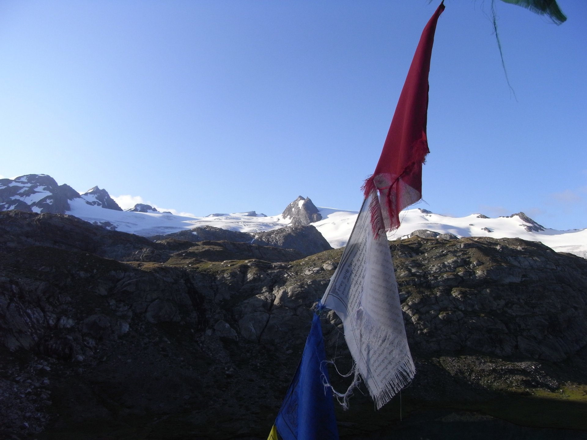
A minibus transfer takes us upstream from the village of La Thuile, in the Aosta Valley. Our hike begins here, with the trail gradually ascending alongside the Ruitor River. The spectacle and the landscapes are already captivating! We ascend the valley to Lake Serrachi. The panorama is superb, and the Italian side of the Mont Blanc massif unfolds in all its width. Our path continues with a very pleasant traverse to the lower Ruitor Lake, revealing the grand glacial cirque of Ruitor before us. The view is magnificent, with the wide cirque perfectly defined by a ridge line, crowned by the Testa del Ruitor, while the Ruitor's glacier tongues descend 3280 feet below into turquoise lakes... Stunning!
Elevation gain: 3,100 feet - Elevation loss: 20 feet - Distance: 4 miles
Day 2
Col du Tachuit - Col de Montséti - Refuge de l'Archeboc
It's time to get closer to these glaciers and share a bit of their coolness. We head towards the Col du Tachuit (8822 feet). The trail winds through alpine meadows and glacial lakes, weaving its way along ancient moraines where stones, rocks, and boulders create a perfect mineral chaos. We then pass through Sassière before ascending to the Col de Montséti (8268 feet). The final slopes leading to the pass are a true delight and bring us to the endpoint of our day at the Refuge de l'Archeboc! The pleasures of effort merge with the joys of hiking in such sublime locations...
Elevation gain: 2,900 feet - Elevation loss: 4,400 feet - Distance: 9 miles
Day 3
Refuge Mario Bezzi
We embark on an adventure on this hiking day from the Refuge de l'Archeboc to the summit of Col du Mont at an altitude of 8639 feet. We will then descend into the splendid Valgrisenche valley, passing through astonishingly diverse landscapes. On the eastern slopes of Ruitor, you'll be surrounded by lush alpine flora and typical mountain fauna. The final ascent of the day leads us to the Mario Bezzi Refuge, where we will spend the night.
Elevation gain: 3,500 feet - Elevation loss: 2,800 feet - Distance: 9 miles
Day 4
Refuge Mario Bezzi - Refuge de l'Épée
A day just as we like them: long and magnificent, offering breathtaking landscapes throughout. We will tackle ascents and descents while enjoying the stunning panoramas that unfold along our route. Our itinerary will take us across suspended trails offering breathtaking views of Ruitor, with several options to explore, whether on classic trails or more challenging off-piste routes. You'll be able to adapt your route based on your preferences and fitness level. We will traverse the Valgrisenche valley on high-altitude paths, with the majestic Mont Blanc massif in the background. The night will be spent at the Refuge de l'Épée, where we can recharge for another day of adventure. An unforgettable experience awaits!
Elevation gain: 2,700 feet - - Elevation loss: 2,300 feet - Distance: 7 miles
Day 5
Refuge de l'Épée - Valgrisenche
We leave the refuge early in the morning to ascend to the Col de la Fenêtre with our packs as light as possible. We will partially return to the refuge to retrieve our belongings. The Col de la Fenêtre offers a 360° view. Afterward, we will replenish our energy at the refuge before descending through the alpine forest towards Valgrisenche, where our taxi awaits to take us back to the Chamonix valley. The end of an exceptional week in the wild trails of Ruitor.
Elevation gain: 1,600 feet - Elevation loss: 4,000 feet - Distance: 8 miles
Booking
Book your activity
Calculate your carbon footprint
Discover the carbon emissions of this activity and add your trip to the meeting point.
CO2 emitted per person for the activity: 80 kg. Learn out more about the footprint calculation of this activity
CO2 emitted per person for the activity: 80 kg. Learn out more about the footprint calculation of this activity
CO2 emitted per person for this activity & journey(s) = 0 kgIn order to limit global warming to +2°C by 2100, the COP-21 agreement stipulates that each human should emit no more than 2t of CO2 per year. According to the French Ministry of Ecology, today European citizens emit an average of 11t per year, and American citizens emit an average of 21t annually., or 8€The price for a ton of CO2 is currently 100€ in the European Union to offset.
Find out more about our zero impact strategy.
x