
Follow us


Authentic hiking Tour of Beaufortain
Duration:
7 days
Price from: 1 250€
Fitness:


Infobulle physique
Physical Level 1: For individuals who engage in occasional physical activity, positive elevation gain up to 250m or distance up to 5km.
Physical Level 2: For individuals who engage in regular physical activity, positive elevation gain up to 500m or distance up to 10km.
Physical Level 3: For individuals who engage in regular endurance activities, positive elevation gain up to 1000m or distance up to 20km or multi-day routes with carrying personal belongings for the day.
Physical Level 4: For individuals who engage in regular endurance activities, positive elevation gain up to 1400m or distance up to 25km or multi-day routes with carrying personal belongings for the duration of the trek.
Physical Level 5: For individuals who engage in intensive endurance activities, positive elevation gain exceeding 1400m or distance exceeding 25km.
Technique:
Infobulle technique
Technical Level 1: For walkers, capable of navigating wide mountain trails suitable for vehicles.
Technical Level 2: For occasional hikers, capable of navigating non-technical mountain trails.
Technical Level 3: For regular hikers, capable of navigating slightly uneven mountain trails with roots or rocks.
Technical Level 4: For experienced hikers, capable of navigating rugged mountain trails with boulders, large steps, or exposed sections.
Technical Level 5: For seasoned hikers, capable of navigating off-trail routes or mountain trails with equipped sections, such as cables or ladders.
Comfort :


Niveau 1. Le confort de votre séjour est minimaliste. Vous dormez sous tente et portez vos affaires personnelles tout au long du séjour.
Niveau 2. Le confort de votre séjour est limité. Vous dormez principalement en refuge ou en auberge, dans des dortoirs, et portez vos affaires personnelles tout au long du séjour.
Niveau 3. Le confort de votre séjour est intermédiaire. Vous dormez principalement en refuge, en auberge ou en hôtel, en dortoirs. Une assistance est prévue pour le transport de vos affaires personnelles, lorsque cela est possible.
Niveau 4. Le confort de votre séjour est élevé. Vous dormez principalement en hôtel, en chambre. Une assistance est prévue pour le transport de vos affaires personnelles, lorsque cela est possible.
Niveau 5. Le confort de votre séjour est très élevé. Vous dormez principalement dans des hôtels 3 ou 4 étoiles en chambre. Une assistance est prévue pour le transport de vos affaires personnelles, lorsque cela est possible.
General information
A legendary hike in Savoie, the Tour du Beaufortain is an unmissable mountain trek for hiking enthusiasts and lovers of the great outdoors.
This 7-day circuit traverses unspoiled landscapes, between high-altitude lakes, alpine pastures, and iconic peaks. Ideal for a trekking adventure, this long-distance hiking trip will captivate you with its diversity and wild beauty. Embark on a fully self-supported journey (no luggage transfer) for an authentic and rejuvenating adventure !
Group booking
The collective formula associates several people who do not necessarily know each other. It allows for a planned program to benefit from an attractive price on fixed dates. This formula is ideal for people looking for the friendliness of a group.
Dates : See below for the group booking module
The trip will be confirmed if the minimum number of participants (5 people) is reached by the trip confirmation date.
Price 2027 : 1250 € per person
This price includes:
- Trip organization
- Guiding by a qualified hiking guide
- Accommodation: 6 nights in mixed-gender dormitories (shared bathrooms)
- Meals (picnic lunches, dinners and breakfasts) throughout the trip (one set menu for the entire group, excluding special diets and allergies)
- Transfers included in the itinerary
This price does not include:
- Personal expenses: souvenirs and drinks
- Any costs resulting from a participant’s personal decision to modify the itinerary or inability to complete a stage (additional transfer or lift, accommodation...)
- Mandatory repatriation insurance and strongly recommended cancellation insurance
- Booking fees
- Anything not listed under “The price includes”
Private booking
Would you like to hike with family or friends? With the private option, you choose your departure dates, subject to accommodation availability. Together with our advisors, you create a trip tailored to your plans. Duration, itinerary, level, accommodation and pace: we help you make the right choices to create a program that suits your group, your preferences and your goals.
You can enjoy a trip designed around you, while benefiting from our local knowledge and having all the organization and logistics taken care of.
The price decreases according to the number of participants.
Further information
In this section, find all the information about this activity. To prepare your trip effectively, refer to the guides’ tips. They share their expertise and recommendations, ensuring you have a great experience
Meeting point : Departure at 7:30am from the reception of the Compagnie des Guides in Chamonix
Level : 4/5 - The Tour du Beaufortain is a challenging hike. With an average elevation gain of 700m, reaching up to 1500m on some days, and a distance of between 10 and 14km, and an average of 6 to 8 hours of walking per day, this route requires a very good level of fitness. The mountain trails are generally well-maintained, although the route may occasionally include off-trail sections. Prior experience with multi-day mountain hikes is necessary.
Itinerary: The guide may need to adjust the itinerary based on weather conditions and/or the physical and/or technical abilities of the group
Guiding policy : minimum 5 and maximum 12 people per guide. The Compagnie des Guides de Chamonix's guiding policy is one of the strictest in the mountain guiding business. It guarantees the most balanced groups as possible as well as high-quality personalised advice. Registration possible from 16 years of age. Registration is not permitted to anyone under the age of 18 without a legal guardian.
Accommodation :
During the trip : 6 nights half board in mixed dormitories. Sanitories are collectives.
Luggage:
Each hiker carries all of their belongings for the entire duration of the trek.
Documentation :
- Participants must have sports insurance with repatriation cover.
We strongly recommend that this also includes cancellation cover.
You can take out insurance offering both of these types of cover when you sign up.
- Participants must also take valid ID with them.
Preparing for the trip : An information meeting is offered the day before at 6 p.m. in the reception area, to meet your group and finalize the last details with your guide. If you are unable to attend, please let us know.
Documents available for download
- Information sheet
- https://reservation.chamonix-guides.com/medias/images/prestations/conditions-de…
- https://reservation.chamonix-guides.com/medias/images/prestations/droits-du-cli…
- https://reservation.chamonix-guides.com/medias/images/prestations/contrat-d-ass…
- https://reservation.chamonix-guides.com/medias/images/prestations/insurance-con…
Equipment
Take special care when choosing your gear to maximize your chances of success. Stick to the essentials to keep your backpack as light as possible. This equipment list is provided to help you pack. It has been tested and approved by our guides. We recommend following it when deciding what to pack in your backpack.
Backpack
- A 40-liter backpack
Clothing
- Breathable long- and short-sleeved T-shirts
- A lightweight fleece jacket
- A warm, lightweight and packable insulated jacket
- A waterproof jacket (e.g. Gore-Tex)
- Hiking pants
- Shorts
- Waterproof pants (e.g. Gore-Tex)
Footwear and evening wear
- Hiking socks
- A pair of high-cut hiking boots with a good sole
- A change of clothes for the evening
- A pair of lightweight flip-flops for the evening
Protection and hiking accessories
- A pair of telescopic trekking poles
- A rain poncho
- A pair of gloves
- A beanie
- A hat or cap
- A pair of Category 3 sunglasses
Personal equipment and essentials
- At least 2 liters of water (water bottle, hydration bladder… one or more containers of your choice)
- Picnic utensils
- A few small waste bags to carry your waste with you
- A flashlight or headlamp
- A sleeping bag liner
- Sunscreen and lip balm
- A basic toiletry kit: towel, earplugs and toilet paper
- A small personal first-aid kit: Compeed-style blister dressings and medication for common ailments such as diarrhea, constipation, sore throat, headaches, aches and pains, and allergies (your guide carries a first-aid kit)
Documents and money
- A valid form of identification
- Money for personal expenses (euros and Swiss francs)
⚠️ The weather changes quickly in the mountains
Even in the middle of summer, you may encounter all kinds of weather. Make sure you bring adequate protection against rain and cold.
Itinerary
Day 1
Mollisoullaz - Refuge des Arolles
We depart early in the morning from Chamonix, and a transfer takes us to Queige. From the heights of Mollisoulaz, we begin our hike in an extraordinary setting. The first objective of the day is the Roche Pourrie, which we skirt to the east in order to traverse the foothills of Mont Mirant and Pointe de la Grande Journée. Reaching the Col des Lacs, we descend towards the Col de la Bathie, then continue to the Refuge des Arolles for the night.
Elevation gain: 1480 meters - Elevation loss: 555 meters - Distance: 14 km
Day 2
Refuge des Arolles - Refuge de l’Écondu
Today, we're taking a trail dotted with lakes and mountain huts - a picture-perfect scene. We cross the Grande Combe to reach Lac Tournant, then pass below Tête Rouge to have lunch at the Refuge de l’Alpage. From there, we descend towards Lac de Saint-Guérin, before climbing back up in the late afternoon via Plan de la Chevalière to reach the Refuge de l’Écondu.
Elevation gain: 605 meters - Elevation loss: 645 meters - Distance: 12.5 km
Day 3
Refuge de l’Écondu - Refuge de Presset
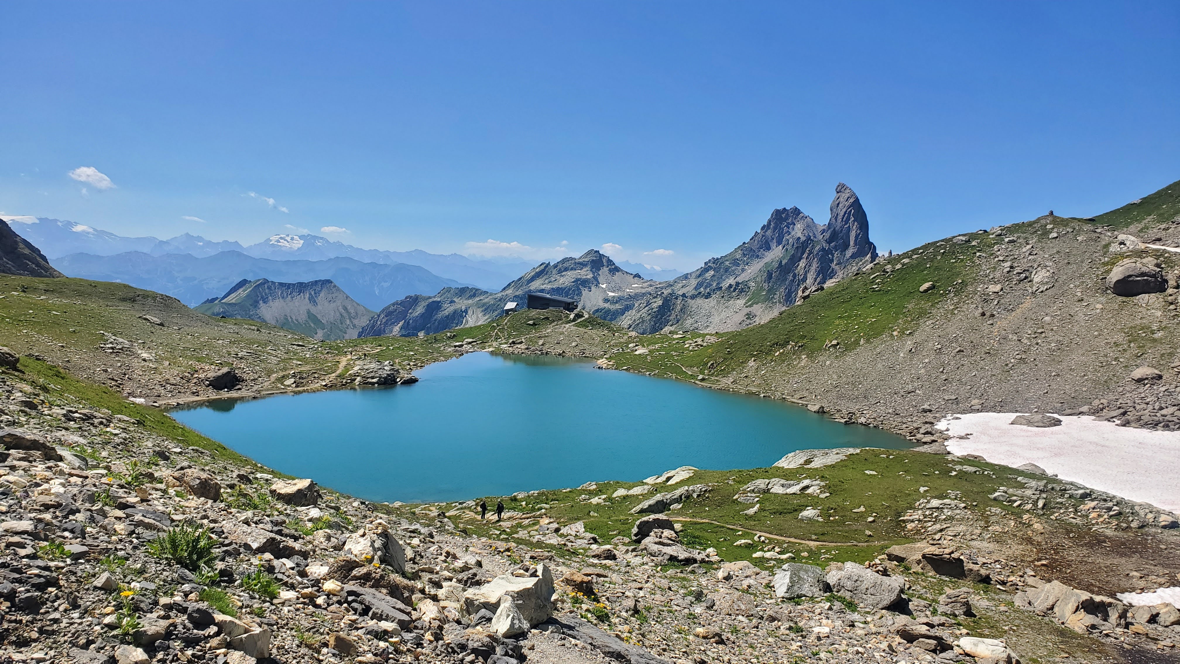
From the Refuge de l’Écondu, we pass by Lac des Fées (1,896 m) to reach the Cormet d’Arêches. The trail then climbs along the ridge towards the Croix du Berger, then the Plan de la Marmotte, before traversing to the Col du Coin (2,398 m). The descent leads us to the Ruisseau du Coin, a perfect spot to refresh ourselves before the final climb to the Col du Bresson. We can see the Refuge de Presset below, where we will spend the night.
Elevation gain: 1055meters - Elevation loss: 400 meters - Distance: 12 km
Day 4
Refuge de Presset - Les Chapieux
It's a day of transition. After a short climb towards the Col du Grand Fond, we cross the Combe de la Neuva shooting range, then follow the stream of the same name, which takes us to the heights of the Cormet de Roselend. We then traverse towards the Chalets de la Raja, before descending to Les Chapieux, where we spend the night.
Elevation gain: 160 meters - Elevation loss: 1080 meters - Distance: 10 km
Day 5
Les Chapieux - Refuge des Prés
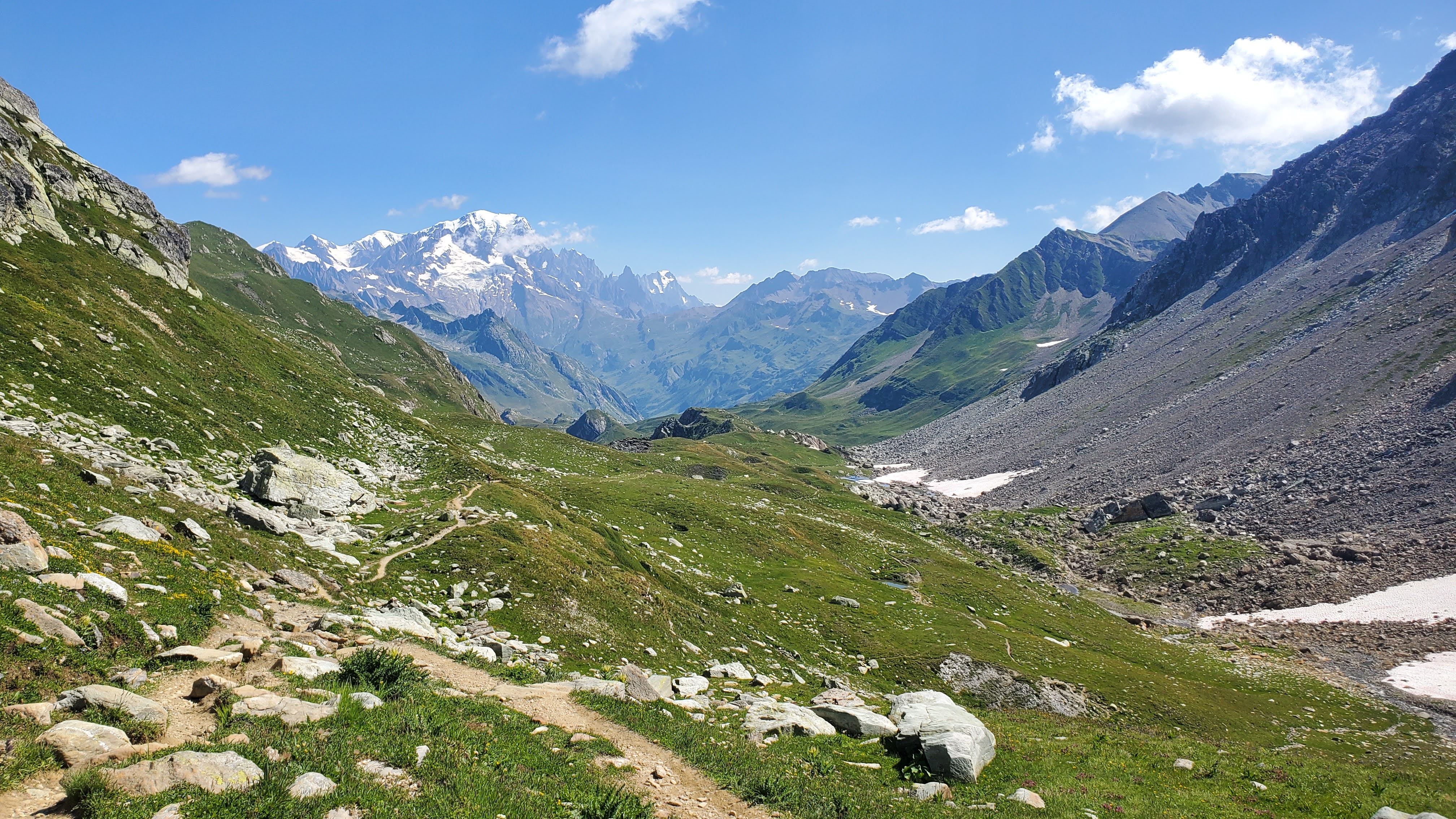
Today, we're heading up towards the Refuge de la Croix du Bonhomme, following the famous Tour du Mont Blanc, but in the opposite direction. We shouldn't encounter many people on the ascent, as the schedules are reversed. At the end of the day, we'll traverse down to the Col du Bonhomme, then descend to the Refuge des Prés, run by our friends from the Compagnie des Guides de Saint-Gervais: a paradise for the eyes and the taste buds.
Elevation gain: 960 meters - Elevation loss: 575 meters - Distance: 12 km
Day 6
Refuge des Prés - Refuge de la Croix de Pierre
We're off for a beautiful day in the mountains. Right from the start, we begin a steady climb to reach the Col de la Fenêtre, then traverse to the Col du Joly. We're at the foot of the Aiguille Croche, with part of the Mont Blanc massif behind us. We then continue on to the Refuge de la Croix de Pierre, high above Hauteluce, where we'll spend the night.
Elevation gain: 665 meters - Elevation loss: 635 meters - Distance: 13.5 km
Day 7
Refuge de la Croix de Pierre - Les Saisies
We end our stay with a final day that includes two summits: first Mont de Vorès (2,067 m), then Mont Clocher (1,976 m). These two ascents allow us to enjoy the magnificent views overlooking Lac de la Gittaz. The descent will then be along a pleasant trail, allowing us to fully enjoy this last day of hiking in the heart of the Beaufortain region.
Elevation gain: 170 meters - Elevation loss: 460 meters - Distance: 10 km
×
Booking
Book your activity
Calculate your carbon footprint
Discover the carbon emissions of this activity and add your trip to the meeting point.
CO2 emitted per person for the activity: 60 kg. Learn out more about the footprint calculation of this activity
CO2 emitted per person for the activity: 60 kg. Learn out more about the footprint calculation of this activity
CO2 emitted per person for this activity & journey(s) = 0 kgIn order to limit global warming to +2°C by 2100, the COP-21 agreement stipulates that each human should emit no more than 2t of CO2 per year. According to the French Ministry of Ecology, today European citizens emit an average of 11t per year, and American citizens emit an average of 21t annually., or 6€The price for a ton of CO2 is currently 100€ in the European Union to offset.
Find out more about our zero impact strategy.
x